
Distant Hill Geology Trail
“The poetry of the earth is never dead.” - John Keats
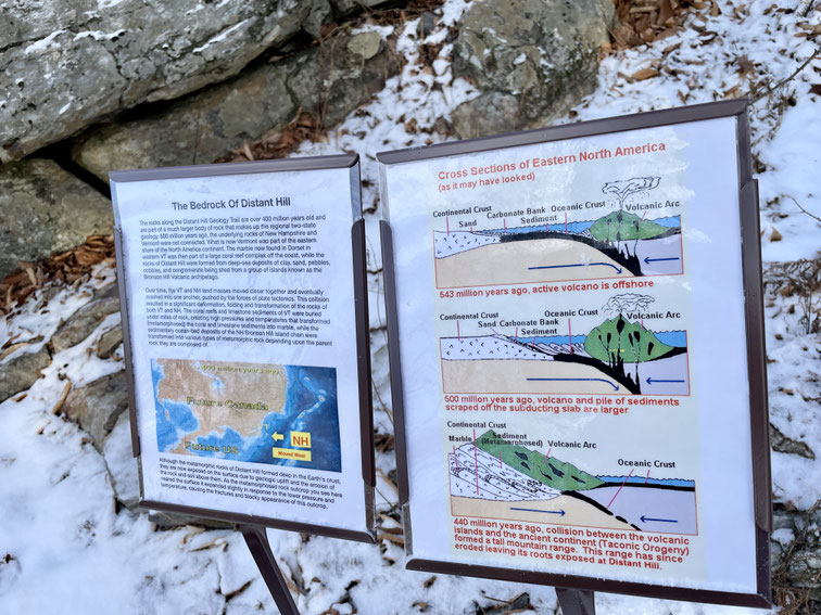
The Geological History of Distant Hill
Distant Hill Geology Trail was built in 2017 to teach visitors about the unique geological history of Distant Hill. The trail features ten different rock outcroppings of geological interest spread along this three-quarter-mile route. Initially, the Geology Trail stood on its own, separate from the other trails at Distant Hill. However, in 2020, we decided to connect it to the Distant Hill Nature Trail.
In 2022, we added a six-foot-wide tread of smooth gravel to the eastern half of the Geology Trail, making the upper loop wheelchair- and stroller-accessible. In 2025, we graveled another quarter mile of trail to the lower loop. Although it is still too steep in spots to be a fully wheelchair-accessible trail, the improvements will make it easier for walking visitors to navigate, and much of the lower loop may even be manageable for power wheelchair users and strollers.
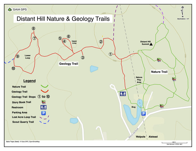
The 10 Stops on the Geology Trail

Stop 1
The Geologic History of Distant Hill
An outcrop of metamorphic rock with informational signs explaining the geologic history of the bedrock that forms Distant Hill.
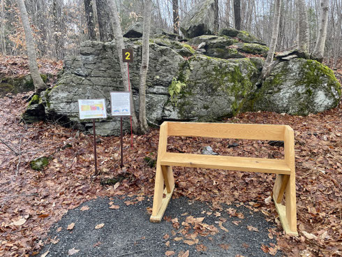
Stop 2
Index Minerals & Metamorphic Grade
This stop gives an explanation of the index minerals present in the exposed bedrock and how these minerals can be used to determine the depth at which the rock formed.

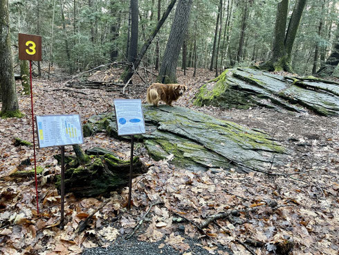
Stop 3
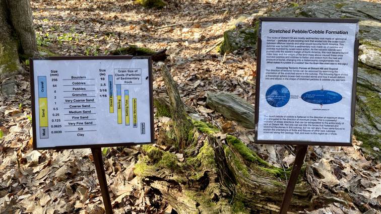
Stretched Pebbles & Cobbles
This stop features two outcrops of distinctive stretched-pebble meta-conglomerate bedrock, flattened and elongated under the immense weight of miles of overlying ocean-floor sediment.
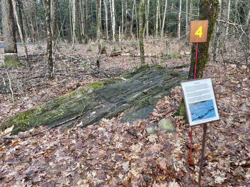
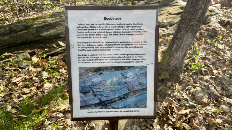
Stop 4
Boudins & Boudinage
This outcrop contains long, oval rocks called boudins. Together, these boudins form what is called boudinage, a sausage-like rock structure caused by the stretching of a strong layer of rock surrounded by a weaker, less stress-resistant rock.
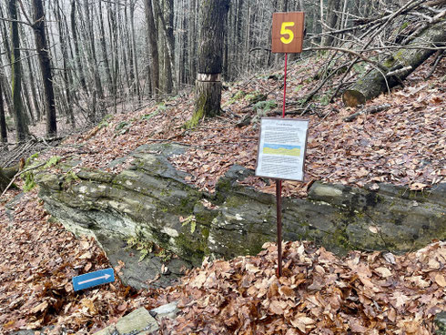
Stop 5
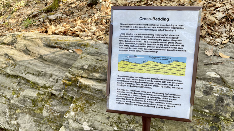
Cross-bedding
This outcrop features an excellent example of cross-bedding, a sedimentary structure that records the direction of ocean currents at the time the sediment was originally deposited.

Stop 6
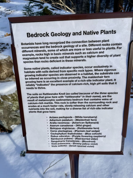
Bedrock Geology & Plant Occurrence
This stop explores the calcium-rich “Rattlesnake Knoll.” The calcium in the bedrock originates from ocean sediments high in precipitated calcite, resulting in neutral pH and fertile soils that support a variety of rare plants.
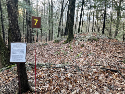
Stop 7
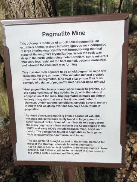
Pegmatite Mine
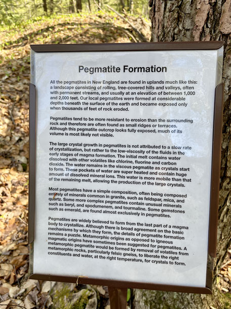
This is a small outcrop of pegmatite—a coarse, crystal-rich plutonic igneous rock—historically mined in this area for mineral and gem crystals such as feldspar, mica, quartz, tourmaline, and beryl.

Stop 8
Pegmatite Dome
This outcrop is actually a dome of pegmatite, the same type of rock found at Stop 8. This outcrop is still intact and has not been disturbed by mining, unlike the previous pegmatite outcrop.
Stop 9
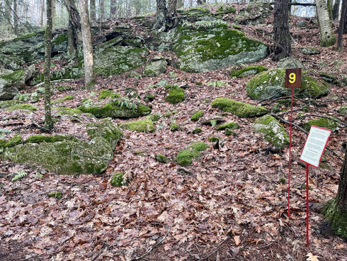
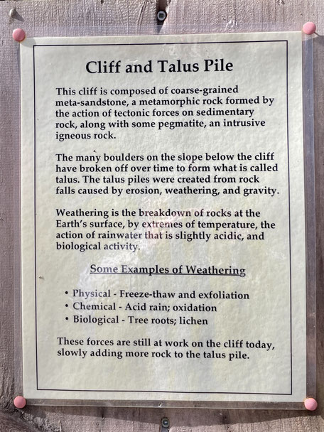
Cliff & Talus Pile
This outcrop consists of a rock cliff with a talus slope (or pile) below. The talus formed through the combined effects of erosion, weathering, and gravity acting on the cliff’s rocks.

Stop 10
Turbidite
The final outcrop is an example of a turbidite: a sudden undersea landslide that deposits clearly defined layers of sediment, ranging from coarse gravel to fine-grained siltstone.

Please Support Our Generous Sponsors


Distant Hill was listed as one of the Top 10 Places to Visit in New Hampshire!
or send a check via Snail Mail to:
Distant Hill Gardens and Nature Trail, 507 March Hill Road, Walpole, NH 03608
Friends of Distant Hill (dba Distant Hill Gardens and Nature Trail) is a nonprofit,
tax-exempt organization under Section 501(c)(3) of the U.S. Internal Revenue Code.
Donations are tax-deductible as allowed by law. Tax ID# 84-3765898